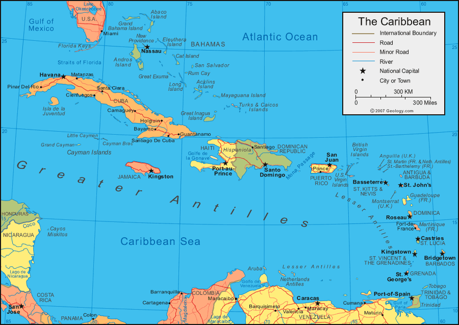
This page will chronicle a 10-day charter in the Leeward Islands. First, a large scale map to provide overall context. The Leewards are in the Northern part of the Lesser Antilles.


The first map puts the Leeward Islands in context of other trips we've done.
In particular, in 2004 we sailed in the Windward Islands from Martinique to Grenada.
That had long passages from Martinique to St. Lucia and then to St. Vincent, but
the passages on this trip were even longer. The toughest was 55 miles from
Nevis to Antigua, but there were two other passages that were in the 40-50 mile
range. The Leeward Islands are tough. Note that we have now sailed
pretty
much the entire Lesser Antilles except for the Guadaloupe through Dominica to
Martinique, and of course the long passage from the Virgin Islands to the
Leeward.
The second map shows the major islands we visited, which were St. Martin, St. Barths,
St. Kitts, Nevis, Antigua, Guadaloupe and Les Saintes. We were told
to give
Montserrat a miss because it has an active volcano, and we didn't have time to
go to Anguilla or Barbuda.


Our first look at the boat, a 44.3 ft sloop called Calliste. The first
afternoon we sailed to Ile Fourche, an island too small to show on these maps a
couple miles northeast of St. Barths. On the way, we
were sailing along when bang, the jib sheet broke (actually, the knot attaching it to
the sail shook loose) and there was the thunderous flapping of the loose jib. Got the
jib in, lowered the main -- and I
made repairs
when we anchored. The next day we motored to St. Barths, which is the highest of the high of all the Caribbean islands.
Huge yachts, Rolex and Gucci stores, lots of very well
dressed people.
Above a restaurant in St. Barths and a Chinese vessel in the harbor at Gustavia, below some of the big dog yachts.


Still in St Barths, a guy in a small day-sailer has fun hot-dogging around the
harbor.


A dawn start (6:00 AM) for St. Kitts, a 45 mile passage that we mostly
motor-sailed. At St. Kitts we had a problem with the anchor windlass motor
and instead of anchoring in a harbor we had to go into
the marina at Basseterre to get an electrician. It turned out that the
ground wire had shaken off a connector on the rough passage. The marina is
hot and not as nice as being anchored, but it allowed us
to top up the water, get a shower and have a nice dinner at an excellent
restaurant on the town square, shown below as evening falls. The Queen
Mary 2 was in Basseterre.


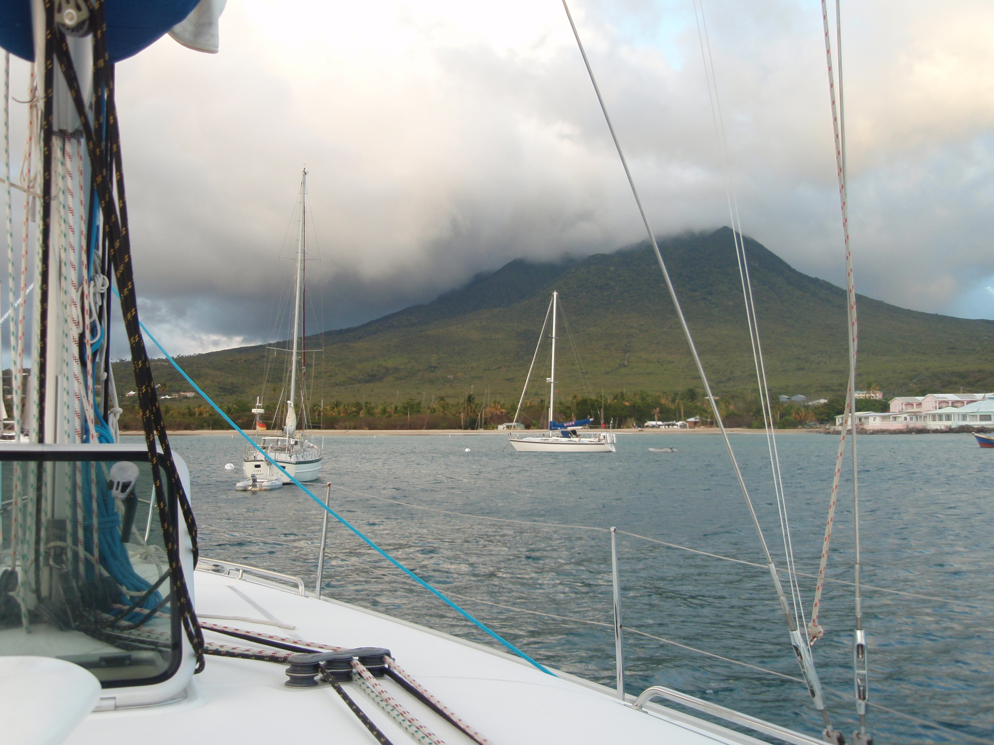
Now a short motor to Nevis, shown below.


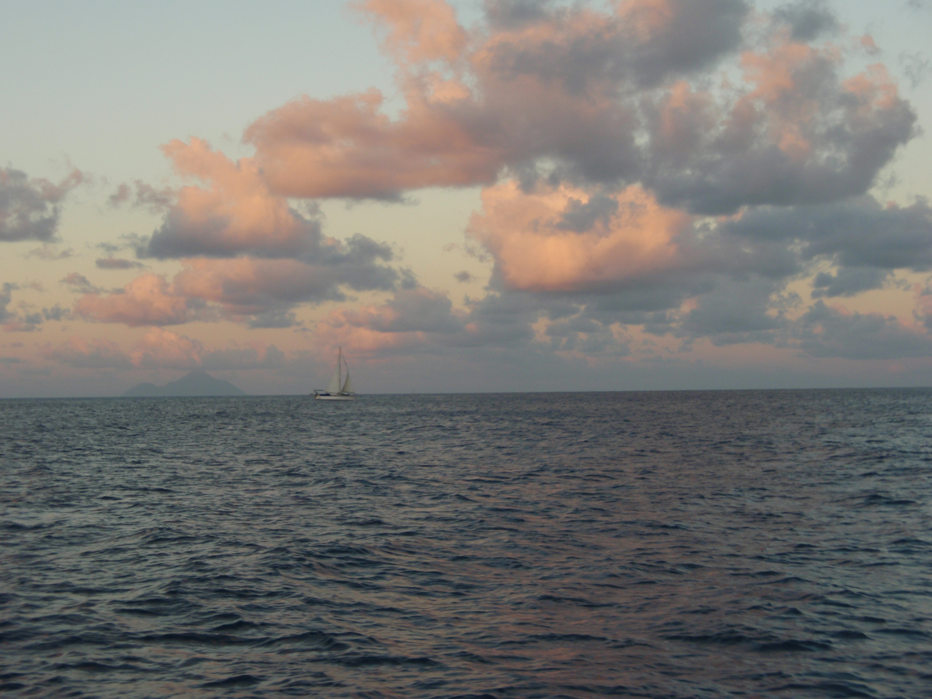
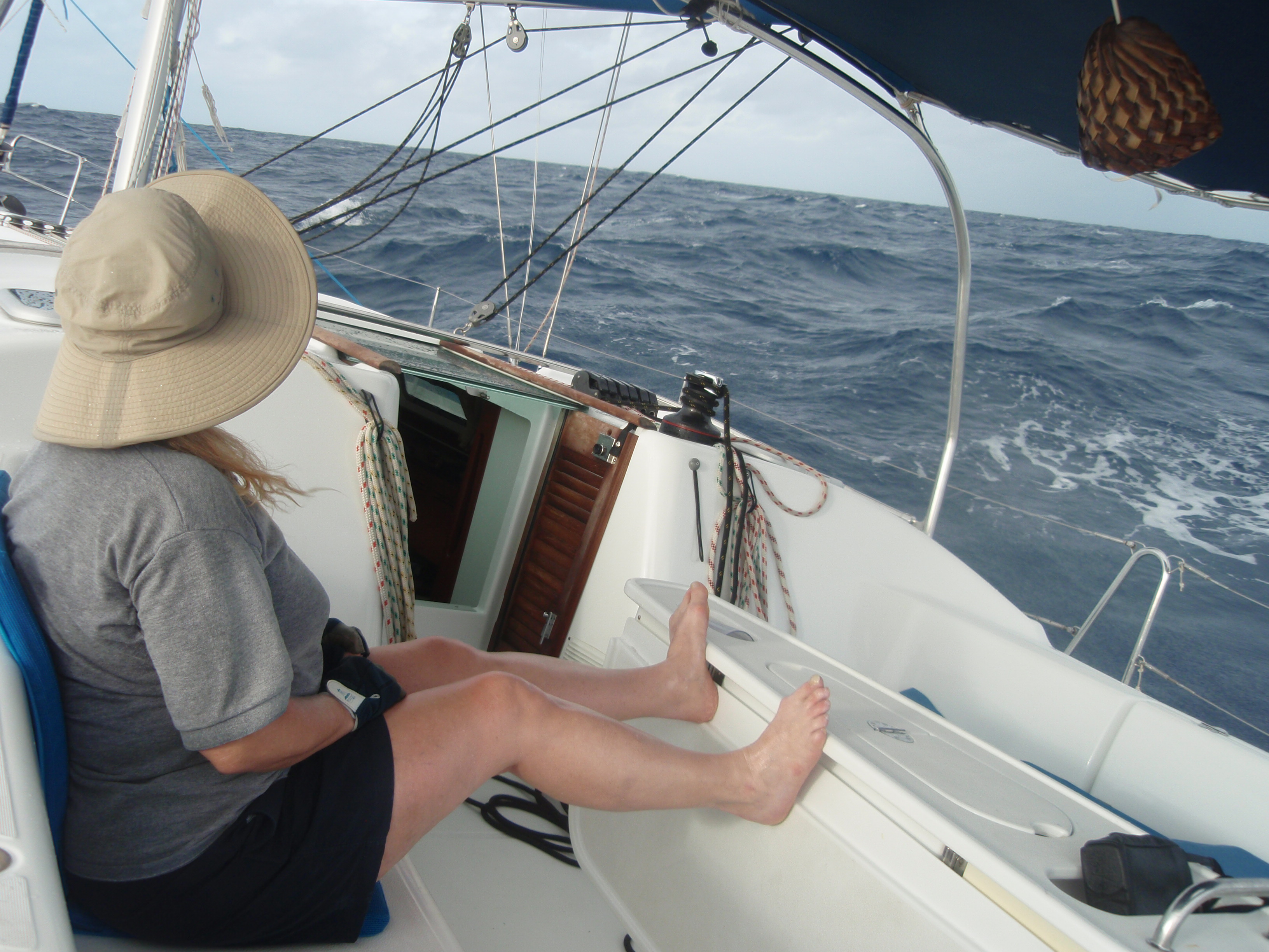
After a pretty sunset in Nevis, another long passage to Antigua. This was
a 55 mile slog motoring straight upwind ... long, brutal and wet. Eight
hours of smashing into the wind and waves. We got a
good early start, however, stealing out just after first light at 6 AM, and we
made it in reasonable time to English Harbor, but just before we got into the
shelter of the land we got hit by a MOTHER rogue
wave.
I looked up and saw two feet of solid water rolling in over the bow into the
cockpit -- and it knocked the boat over pretty far. Debby said she thought we
were going to die, and I must admit that I
recall
saying to myself, "I don't think these boats can be knocked
down". And of course, it wasn't. It just shed all the water happily and came
back to the next wave. These heavy keel sailboats can take
tremendous
punishment, and as such things go this was not all that much. It sure was
impressive to us, however, basically to be personally underwater momentarily.


English Harbor in Antigua is a very cool place. Just to the West is
Falmouth Harbor, a large open bay. English Harbor, however, is a real
hole-in-the-wall. It's been fortified for hundreds of years, dating
back to Lord Nelson, who built the fort on Fort Berkeley Point.


Note the bow sprit above -- looks like a telephone pole to me.


Now, below, a short hike to the fort.


From the fort we see a two-master coming in the harbor, sailor furling the sail
on the bowsprit pretty much like they did it in Lord Nelson's day.


In the photo on the left above, note the V-shaped wall giving a field of fire to
a cannon. Below left one of these cannon embrasures from the other side.
("Embrasure" means "a flared opening for a gun in
a wall or parapet").


In the middle picture, the fortified ammunition bunker. That's our boat,
seen from the fort, on the right.


I'm not sure of this, but I think that the bollard sunk into the rock in the
picture to the right above may have
been intended
to anchor a chain stretched across the harbor mouth.


The guard house.

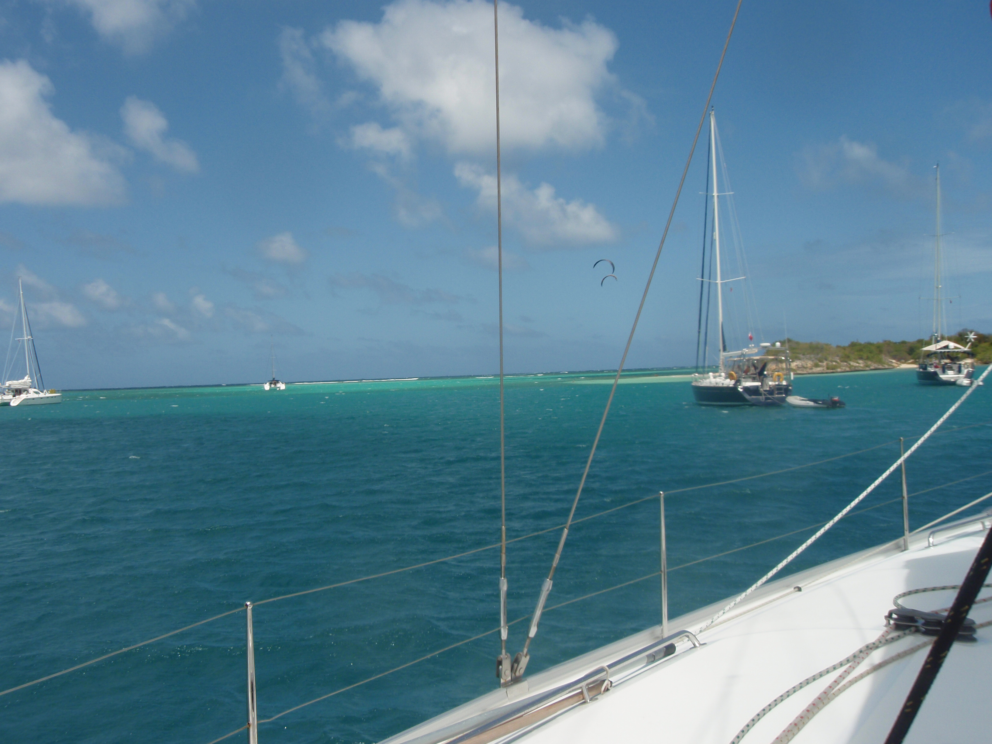

The next day we went a short way from English Harbor to Nonesuch Bay, also on
Antigua. A kind of tortuous, dogleg passage from the South into a vast, protected bay.
We anchored just North of Green
Island,
protected
from the Atlantic swell by a reef that extends for several miles north of the
island, but it looks like there is nothing between the boat and Africa. All
those yellow areas on the map correspond to
shallow water and reef, but to the eye it just looks like blue water. Of
course it was a pretty windy anchorage, but that
wind was
being used by the para-sailers, of which there were many.


We dingied over to
Green Island and watched the para-sailers taking off, which was interesting.


Evening in Nonesuch Bay, Debby makes Bananas Foster flambé
-- or at least something reasonably close. Note the flames in the middle
picture above.


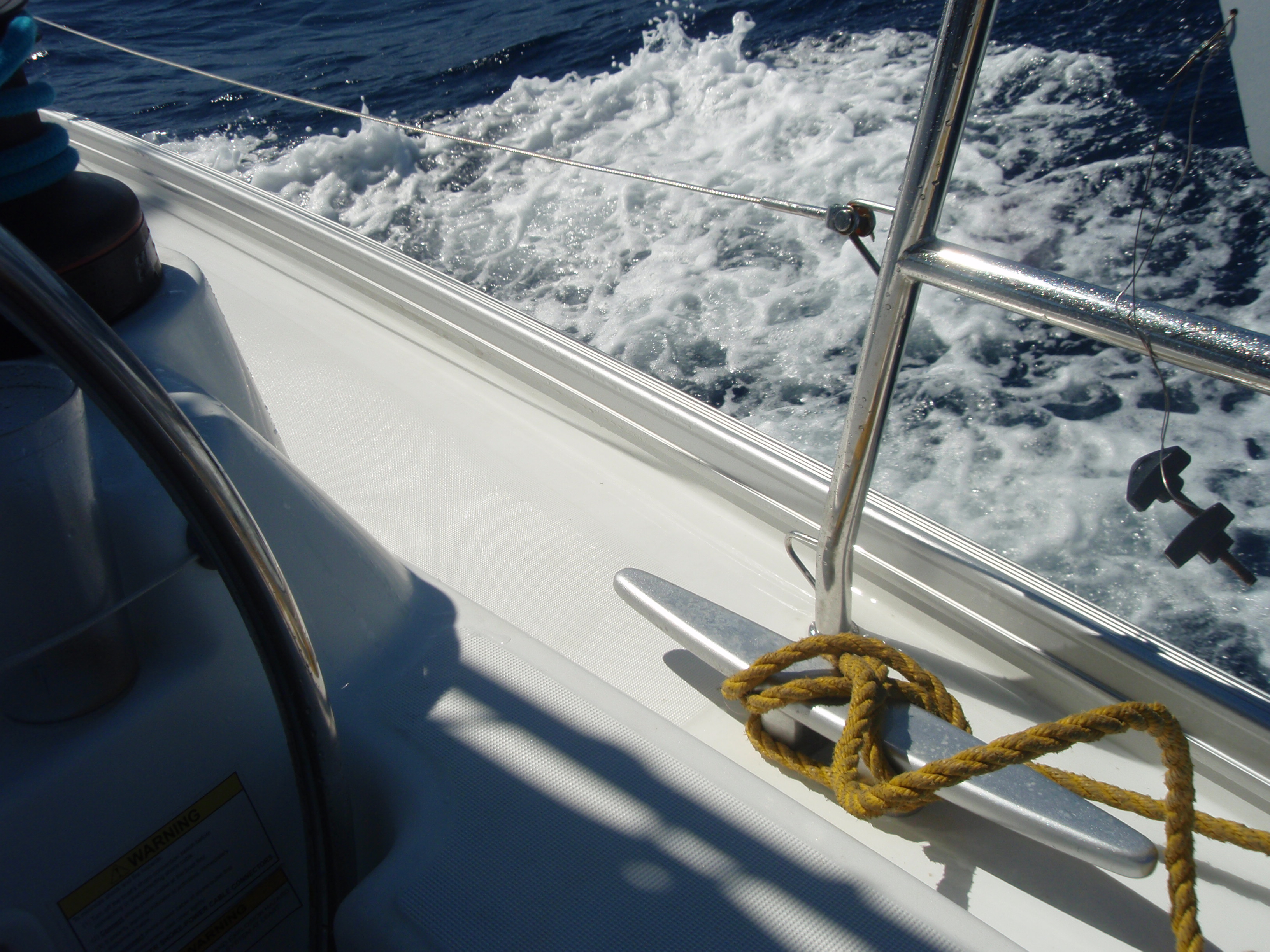
Then another long sail, again starting at 6 AM, straight South to Deshaies
in the NorthEast of Guadaloupe, which is a big island. Because this was
another long day (45 miles or so), we mostly motor sailed
in order to make
time -- and did we ever. Over ten knots at some times. At the end of the
sail, however, when we brought down the main, we had a substantial problem.
Instead of furling nicely into the
basket it spilled out of the basket onto
the deck in a mess. I was afraid it would catch the wind and balloon over
the side into the water, which would have been bad, but it was sort of
wedged up against
some of the rigging and didn't do that, so we limped into
the harbor to make repairs. I was actually able to take care of this
myself. It turned out that one of the lines that suspend the basket along
the
boom broke (actually, the connector that was sewn into the basket just
ripped out), but I was able to loosen that part of the rigging and bring
down the broken end by pulling down other parts of the rigging
that were
still standing, then I jury rigged it by tying it to the steel cable that
runs around the top of the basket. It held for the rest of the trip,
although we later found that there was also damage to the end
of the basket. I think that basket will need to be replaced. No pictures of the problem -- we were not in a picture taking mood.
Deshaies was very, very still -- because there is a lot of Guadaloupe
between us and the wind. I did go into town to try to make customs (which
I was unable to do), but the interesting thing was that there was no dingy
dock. I left the dingy in a perfectly awful place on some rocks partially
blocking the launching ramp, and when I came back one of the locals told me
that the dingy dock was destroyed a couple months ago by some really serious
winds. "No place for dingies now".
This business of customs was a real pain. These islands are a lot of
different nations, and we had to make customs in St. Bart, then St. Kitt,
then Nevis, then Antigua (twice, in and out), then Guadaloupe. Each one
wants money, but the problem is just the time it takes. They all want to
know different information, lots of which I don't know. Like the brand and
horsepower of the deisel, for Pete's sake. And currency -- first it was
dollars, then Euros, then EC's (Eastern Carrbbean), then Euros again.


A big cruiser lit up at night in the Deshaies harbor, then
From Deschaies to Basse Terre, also on Antigua, where we finally were able
to make customs. They hassled me unmercifully about the boat documentation
-- for a while it looked like I was going to have to pay a 150 Euro fine --
but eventually the docs they wanted showed up in the boat bag. That
anchorage was still, hot and ROLLY (because just beyond the next point the
full Atlantic swells were kind of leaking around). Not a great place for
us. Note the staysail on the boat above right. I'm not sure I've
ever seen that before.


Evening in Basse Terre, then five miles to Les Saintes.


At Les Saintes we had a choice anchoring near the town or across the bay behind an uninhabited (more or less)
island called Ilet a Cabrit.
We chose the
island, of course, and it was nice, although it was kind of disconcerting that
the wind blowing around the island ended up
coming from the West, not the usual
East, pushing us back toward the island and
its little dock. A guy motored into the dock early in the
morning and started
calling for the goats -- "Wooee, wooee". The came to him across the top of the
ridge, from right and left, and the last
I saw there were eight or ten following
him like the pied piper.


A not-so-long- sail up to near Pointe a Pitre, our final destination. The lady
that briefed us wanted us to do that sail the morning we had to turn the boat in
-- and catch a plane at 2. That seemed too
hurried to us, so we did it the day before just to be more relaxed, and it was a
great sail. We had plenty of time so we only motor sailed for a short time.
Mostly a really nice, classic sail, moving right along,
tacking nicely at the end, bringing in both sails neatly -- and made landfall
just about where we wanted to be. The course I laid the night before was just
about perfect. We anchored behind Ilet du Gosier
in a huge expanse of shallow water, well protected from the waves (so not rolley),
but plenty of wind, so cool. Nice place. Our neighbors were almost all people
who obviously live on their boats. The
nearest one had two BIG, black dogs on board. We've seen little dogs before,
but never big guys.
In the last picture below, an aerial view of Ilet du Gosier in the distance,
taken from the plane on the way out. We were anchored in the right part of
the crescent.

